
Search a Hesperia Street
A useful Hesperia street directory search starts with one full address and a defined scope. Decide whether the goal is the parcel at that address, the touching lots, or a whole street segment between two cross streets. The answer changes the amount of data and the risk of including unrelated parcels. Hesperia's large-lot areas, planned subdivisions, corner parcels, common areas, and private drives make a map boundary more reliable than a simple sequence of house numbers.
Use the City of Hesperia locator to normalize the address. Keep the match address, score, address type, house number, direction fields, and map point. Then open the county parcel layer and confirm the point falls inside the intended polygon. Only after that should the assessor and recorder names enter the trail. Historical directories and census schedules add dated household evidence later.
- Enter the full street number and name in the City address locator and correct a weak score or intersection result.
- Select the matching county parcel polygon and note the APN, tract pattern, map extent, and adjoining lots.
- Use the documented assessor route to distinguish situs, mailing address, owner fields, and parcel history.
- Search the recorder by the identified party, document title, date, and grantor or grantee role.
- For a past household, pair the dated property trail with a verified directory, census, permit, obituary, or probate source.
Hesperia Address Records
Several Hesperia record sets can be approached by address, but each answers a different question. The City locator standardizes the place. The county parcel service shows spatial relationships and an owner display field. The assessor supplies parcel and assessment context. The recorder supplies indexed instruments after the APN-to-name bridge. City permits and code records add project or case dates. Voter data has strict access rules, while historical directories show a household at a particular time rather than a continuous presence.
| Record set | Keeper | What it can show | Access |
|---|---|---|---|
| City address locator | City of Hesperia | Candidate address, score, type, and coordinates | Free REST service |
| Parcel layer | San Bernardino County | Polygon, APN-related attributes, adjoining lots | Free map or service query |
| Assessor PIMS | County Assessor | Situs, owner or mail recipient, characteristics, history | Public or access-dependent modes |
| Recorder index | County Recorder-Clerk | Grantor, grantee, title, number, date since 1925 | Free index, counter images |
| Permits and code files | Hesperia City Clerk and departments | Address-dated work or case material when disclosable | Reports, counter, or CPRA request |
| Historical directory or census | Libraries and archives | Dated household or address snapshot | Collection-dependent |
The table is a chain, not a merged roll. A parcel number can connect the map to the assessor and help select the correct deed parties. It cannot turn a map owner into a list of every person at the address. The voter-file route is not a general street browse, and a permit applicant is a project participant rather than proof of residence.
Hesperia Street Parcel Search Fields
The county PIMS manual describes eight modes: Parcel Number Search, Name Search, Situs Search, Assessor Map Book Search, Parcel Map Search, Tract Map Search, Attached Parcel Search, and Property ID Search. The manual also notes that some situs, tract, and property-ID functions belong to the Inquiry Service. The live public landing page does not expose a stable form that confirms each current control, required marker, result cap, or export option. A responsible Hesperia street directory should describe the documented modes without promising a field that the current access level may not show.
| Documented PIMS mode | Use in an address search |
|---|---|
| Parcel Number Search | Search the APN once the county map identifies the parcel. |
| Name Search | Follow a documented owner-name route and test initials or entity forms. |
| Situs Search | Try the physical address where the available Inquiry Service supports it. |
| Assessor Map Book | Use map-book references to place the parcel within assessment geography. |
| Parcel or Tract Map | Connect lot, block, tract, and recorded map clues. |
| Attached Parcel or Property ID | Follow linked parcels or an internal property identifier. |
Parcel history and roll-value history can help explain why the current address appears in an older form. Keep the physical situs separate from the tax-mail destination. A PO box, trust, entity, or out-of-area mailing address may be legitimate and says nothing by itself about who is present at the parcel.
The county's property-information gateway is the official launch point for these Hesperia parcel searches. The assessor warns that assessment information does not determine legal ownership, so title questions continue to the recorded instruments.
Hesperia By-Street GIS Address Matching
The City of Hesperia Locator_CW geocoder exposes Find Address Candidates, Reverse Geocode, and Geocode Addresses. Its documented input labels are Street or Intersection and Single Line Input, each with a maximum length of 100. Candidate output can include Loc_name, geometry, match score, Match_addr, Addr_type, AddNum, Side, StPreDir, and StPreType. The geocoder answers where an address maps. It does not answer who owns the parcel or who lives there.
After a candidate is chosen, open the county parcel layer and inspect the polygon rather than trusting the label alone. A corner parcel may front one road and carry a situs label from another. A flag lot, split parcel, common tract, or vacant lot can defeat a simple next-number assumption. For a street segment, record the cross streets, map extent, inspection date, and included polygons. The public layer supports standardized queries and has a maximum record count of 1,000, but a small visual pass is safer than a citywide pull.
Hesperia's Locator_CW geocoder is shown in this Hesperia street directory image. 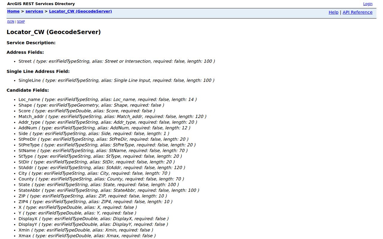 The address candidate is the first link in the chain, not an owner or occupant result.
Hesperia Street Deed Chain Steps
The recorder index is party-based. Once the assessor or parcel layer gives a current indexed name, search that name as a grantee and inspect the date and title for the likely acquisition deed. The seller on that instrument is the earlier grantor. To move backward, search that seller as a grantee and match the same legal description, APN clue, subdivision, co-owner, and time period. This seller-to-prior-buyer method is more reliable than searching a surname across every document.
Use the document title to avoid false links. A deed of trust names a security interest. A reconveyance releases that interest. A lien or easement can involve a party without transferring ownership. The online index reaches 1925 to the present and omits document images. Earlier deeds require an inquiry at the Recorder-Clerk counter or the County Archives. Maps can be purchased only at the San Bernardino Hall of Records, even though Hesperia offers local document viewing.
Address-to-name bridge. The recorder cannot start with a Hesperia street address. Use address, parcel, APN, and assessor name first, then search grantor and grantee roles.
Hesperia Street Permit Timeline
Hesperia permits and code cases add a dated physical layer to the street directory. The Permit Center publishes Building Permit Activity summaries for 2022 through 2024 and inspection activity for 2022 through 2025. Rows can include permit number, status, inspection date, address or APN, inspection type, project type or subtype, and result. The City also links a Request to Review Records form. Public access to older records is not stated as a complete online run, so an address and date range should be sent through the City's records channel when the report does not answer the question.
Code enforcement follows an address-based case sequence and may include complaint, inspection, notice, citation, appeal, or abatement steps, subject to exemptions and redaction. A contractor, applicant, or owner field identifies a project role. It does not prove that the person lived at the property. Keep the permit date, project description, and record status together.
Hesperia's code-enforcement process is shown here. 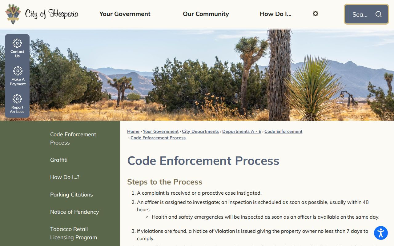 Address-linked case material helps date change along a street without becoming a household roll.
Hesperia Criss-Cross Directory Trail
A reverse or criss-cross directory starts with the address and then names a listed occupant, business, or telephone subscriber. An ordinary alphabetical directory starts with a surname. Either format can help bridge census years and deed dates, but the research did not verify a Hesperia-specific publisher, exact year span, or continuous reverse-directory run. Search the Hesperia Branch catalog with Hesperia, Victor Valley, Victorville, San Bernardino County, telephone directory, Polk, Cole, and criss-cross terms. Ask reference staff to identify the volume, publisher, edition year, page, and any local coverage boundary.
Read the volume's key before treating a mark as ownership, residence, widowhood, or a business relationship. A first appearance can reflect a new publication area, a move, or a newly listed telephone. A disappearance can reflect death, relocation, no telephone, nonlisting, or a gap in the collection. Pair the entry with a census schedule, obituary, permit, assessor record, or deed, and keep owner and occupant in separate columns.
The historical shelf is treated in full on the Hesperia city directories page. Here, the criss-cross volume is a street tool that fills a dated gap, not a replacement for the current address chain.
Hesperia Street Address Keys
Five address forms can appear in a Hesperia street directory search. The situs is the physical parcel label. The mailing address is the destination for assessment or tax notices. The APN is the county parcel identifier. The legal description carries lot, block, tract, or metes-and-bounds language. The ZIP Code is a USPS delivery geography. These keys overlap, but they do not have the same authority or purpose.
- Parcel
- A mapped unit of land used by the county for assessment and spatial reference.
- Situs address
- The physical location label attached to a parcel, not a list of occupants.
- Plat or tract map
- A recorded map that ties lots and blocks to a legal geography.
- Criss-cross directory
- An address-first historical directory that may name a listed household or phone subscriber.
- Legal description
- The recorded land description that can preserve continuity when a street label changes.
When an address fails, compare the map, APN, tract, lot, legal description, cross streets, and postal label. The research did not locate an authoritative Hesperia-wide renumbering concordance or city grid rule. That gap is a reason to ask Planning, Building and Safety, the county, or a librarian for a dated source, not to infer a new number from a modern ZIP.
Hesperia Street Directory Limits
A street directory can show parcel relationships, recorded parties, project history, and dated historical entries. It cannot identify every person at an address. Household members who never appear in a deed, people using a protected address, utility customers, delivery recipients, and other private occupants remain outside the ordinary parcel chain. The public voter system is not a casual street search, and motor-vehicle address information is restricted under federal and California law.
California's voter rules distinguish a named specific-voter record from an unidentified set such as everyone on one Hesperia street. Approved files can include residence and mailing addresses for an authorized purpose, but personal, private, or commercial communication and harassment are prohibited. For public-facing street research, parcel adjacency, district maps, aggregate registration reports, permits, and historical sources are safer and more accurate than promising a named block roll.
Lawful personal use. Use Hesperia street records for family history, property history, civic research, and personal safety awareness. Do not use a street directory to stalk, harass, intimidate, or expose another person.
Hesperia Street Recorder Counter
The High Desert Government Center Recorder-Clerk counter is at 15900 Smoke Tree Street, first floor, in Hesperia. Research notes list public index and document viewing from 8:00 to 11:00 a.m. and noon to 5:00 p.m., with appointments strongly encouraged and prioritized. The web index remains useful for names, titles, dates, and document numbers, but the counter matters when a legal description, vesting language, signature page, map reference, or older book is needed.
Mail copy requests go to the county address in San Bernardino, with check or money order. ARC publishes copy charges and a fee calculator, while the Hesperia counter handles local viewing. A focused request should name the document number or likely date, the parties, the record type, and the parcel clues. That preparation keeps a street-by-street search tied to a specific instrument.
The High Desert Government Center service page is the practical local handoff for the Hesperia street directory's deed and map questions.